S400 Autonomous Inspection Drone-Applying Biomimetic Vision Technology
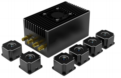
Biomimetic Vision is a visual self-driving system which independently developed by INTELLIFLEYE. It has functions including control and navigation, three-dimensional space perception and positioning, path planning and decision-making, and real- time autonomous obstacle avoidance.
Biomimetic Vision is a visual self-driving system which independently developed by INTELLIFLEYE. It has functions including control and navigation, three-dimensional space perception and positioning, path planning and decision-making, and real-time autonomous obstacle avoidance.
Relying on powerful edge computing capabilities, Biomimetic Vision can realize real-time perception and 3D map construction of the surrounding environment, and complete path planning and intelligent decision-making based on the spatial information of obstacles in the surrounding environment.
INTRODUCTION
Biomimetic Vision could be easily installed, integrated, and used as a common sensor due to the highly integrated modular design; Flexible interface design and software configuration options provide users with maximum flexibility to adapt to different application scenarios; Due to the customized design, the protocol can be directly used for existing unmanned devices such as drones, unmanned vehicles, unmanned boats, and robots.
Product Characteristic
-L4 Autonomous driving
-Multiple redundant system
-Indoor and outdoor navigation without GNSS
-Path planning and obstacle avoidance
-Anti-electromagnet interference
-WIFI+4G/5G double data link
-Simplified vehicle operation
-Realtime 3D reconstruction and display
-Flexible software configuration
-Multiple application mode

Application Scenario
Inspection
Fulfill the requirements for the inspection in a strong electromagnetic interference environment, an indoor complex environment, and no GNSS environment.

Search and Rescue
Fulfill the requirements for the search and rescue in a strong electromagnetic interference environment, indoor complex environment, and no GNSS environment

Mapping
Fulfill the requirements for the mapping in a strong electromagnetic interference environment, indoor complex environment, and no GNSS environment

Ground Control Station
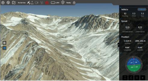
The 3D satellite map cannot only reflect the latitude and longitude coordinate information but also intuitively reflect the relative altitude information of the flight trajectory of the aircraft and the surrounding geographical environment. This allows ground station operators to more reasonably set waypoints and trajectory planning for flight missions, improve flight efficiency, and reduce mission risks.

With the help of Simplified Vehicle Operation (SVO), the flight control is simplified to just tap the target location, and the drone can automatically fly to the target. Even mission executives who have never had any experience in drone remote control can quickly get started. Due to the application of digital twin technology, SVO can display the 3D flight trajectory and the 3D reconstruction model of the surrounding environment in real-time, providing visual information for different mission scenarios.
- Reinforcement Learning Enables Bipedal Robot to Conquer Challenging Terrain
- Drones for 3D Indoor Exploration-Cultural Relics Protection and Indoor Survey
- Industry Application: Intelligent Unmanned Operation Solutions for Lakes – Rapid Deployment for Continuous Protection
- High-Altitude Cleaning Case Introduction - Drone Spraying and Cleaning
- New Performance: SLAM Handheld Lidar Scanner + External Panoramic Camera New Combination

