New Performance: SLAM Handheld Lidar Scanner + External Panoramic Camera New Combination
The SLAM100/SLAM2000 handheld laser radar scanner is the main mobile measurement equipment developed by the company. It integrates the industry-level SLAM algorithm and can obtain high-precision and high-definition three-dimensional point cloud data of the surrounding environment without GNSS, achieving on-site reproduction with surveying and mapping-level accuracy.
The equipment has been widely used in real estate surveying and mapping, ancient building protection, underground space, volume measurement and other fields. With its outstanding performance of 360 degrees without dead angles and tens of millions of pixels, the panorama can restore the scene more realistically and provide a better data carrier for visual applications. Combining the advantages and characteristics of the SLAM handheld laser radar scanner and the panorama, targeting demand, deepening the market, and actively iterating and upgrading products, the new combination of SLAM100/SLAM2000+ lightweight panoramic camera is launched, which can not only achieve surveying and mapping-level accuracy, but also restore the on-site environment more realistically.
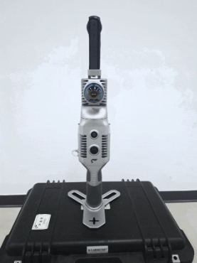
SLAM2000+ panoramic camera
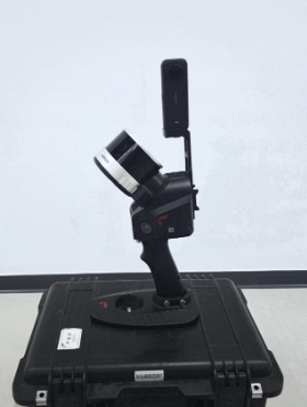
SLAM100+ panoramic camera
Advantages
The new combination of SLAM100/SLAM2000+ lightweight panoramic camera provides a more economical and efficient technical solution in scene applications requiring high definition. This solution is suitable for scenes such as traffic accident scene restoration, ancient building protection, precise point cloud annotation, smart cultural tourism, digital factories, etc., and has significant advantages in practical applications.
Quick Integration
SLAM100/SLAM2000 can be quickly integrated with a lightweight panoramic camera through a matching bracket. It can be used in handheld mode, backpack mode, and static station mode, and can be equipped with the Fei S-RTK100 multi-functional portable RTK module. The panoramic camera can operate completely autonomously without electronic links and data communications with the SLAM host.
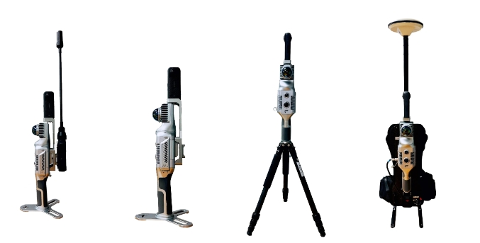
Users can use it directly without calibration
SLAM100/SLAM2000 has completed the calibration integration of Insta360 ONE RS and X4 cameras, and users can use it directly. It also supports other common panoramic cameras and can achieve fast calibration.
The collection operation is simple and easy, and the data can be processed with one click
In the SLAM GO POST Pro data solving software that comes standard with SLAM100/SLAM2000, processing can be done with one click to output the fused point cloud and panorama. The result data is in a standard format and can be directly used on commonly used panoramic data display and management platforms.
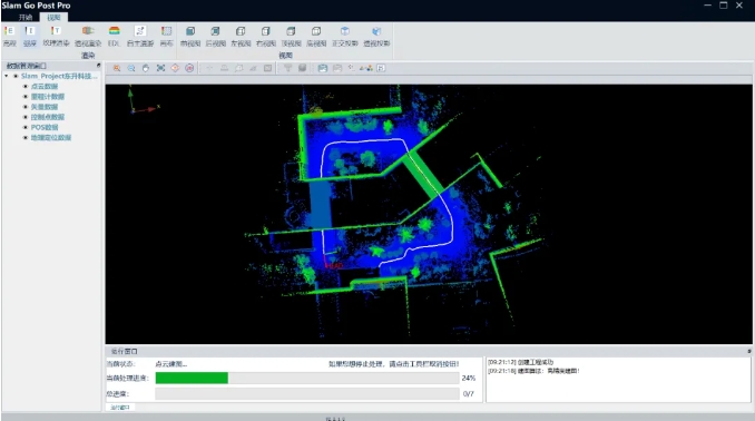
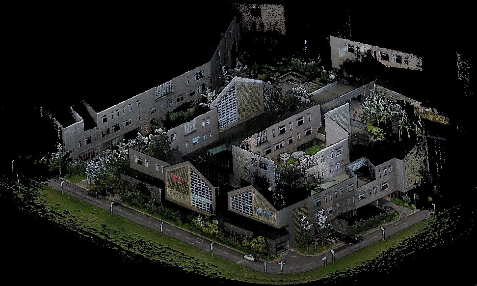

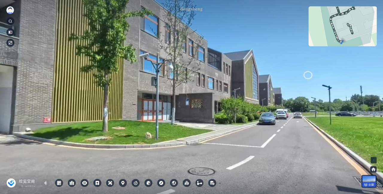
Matching the Huijian space management platform to form an integrated solution. Realize the functions of one-click upload of results, point cloud and panorama fusion browsing, point of interest annotation, space measurement, and report output.
Parking Case
According to customer requirements, the results are displayed on the Web, and the panorama and point cloud can be viewed, the license plate number and ground markings can be clearly displayed, and precise measurements can be made on the panorama, and measurement reports can be exported. This case requires both the acquisition of high-precision point cloud data to meet measurement requirements and the clear display of detailed information such as license plates, and the precise fusion of the two to achieve intuitive measurement on the panorama. The combination of SLAM2000+Insta360 can well meet the needs of this scenario. The measurement area is two rows of vehicles of 37 meters by 18 meters in the parking lot, and the on-site collection takes only 6 minutes.

Digital management of construction sites
For construction site management, the customer required tracking of construction progress, preservation of on-site digitalization results, and checking of facility installation accuracy. Based on the above requirements, SLAM2000+Insta360 was selected to collect data on site multiple times and quickly, and the data was saved and displayed on the Huijian Space Management Platform.
SLAM100/SLAM2000 has outstanding flexible scalability and can be adapted to common panoramic cameras on the market. By leveraging the excellent imaging capabilities of panoramic cameras, the competitiveness of SLAM products can be further enhanced, bringing better-quality and more targeted solutions to industry users, meeting the complex needs of different users in diverse scenarios. While improving work efficiency and quality, it reduces costs and risks, injecting strong impetus into industry development.
- Reinforcement Learning Enables Bipedal Robot to Conquer Challenging Terrain
- Drones for 3D Indoor Exploration-Cultural Relics Protection and Indoor Survey
- Industry Application: Intelligent Unmanned Operation Solutions for Lakes – Rapid Deployment for Continuous Protection
- High-Altitude Cleaning Case Introduction - Drone Spraying and Cleaning
- New Performance: SLAM Handheld Lidar Scanner + External Panoramic Camera New Combination

