Drones for 3D Indoor Exploration-Cultural Relics Protection and Indoor Survey
In recent years, interest in using drones for indoor applications has grown significantly. Traditionally, most drone applications have focused on outdoor environments such as forests, fields, and construction sites. However, advancements in indoor SLAM (Simultaneous Localization and Mapping) and 3D mapping have sparked interest in exploring the potential of drones for indoor operations.
Drones excel in indoor environments due to their ability to cover large areas faster than wheeled robots. By leveraging aerial mobility, drones can traverse different heights within buildings, creating accurate maps of various structures. This capability allows for efficient exploration and mapping of complex indoor environments. Additionally, drones exhibit versatility, navigating through narrow spaces or challenging terrains like chimneys and staircases. These features make them valuable tools for completing tasks that are difficult or hazardous for humans. Ultimately, these flying robots can bring potential benefits to industries by enabling efficient exploration and mapping while ensuring safety and autonomy.
3D Mapping Drones for Indoor Exploration
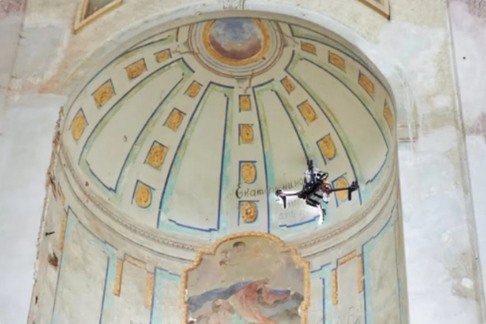
A dedicated team has developed a series of solutions tailored to various scenarios. In collaboration with the Abu Dhabi Technology Innovation Institute (TII), they designed three custom drones specifically for exploring and mapping indoor spaces. These drones are equipped with 3D LiDAR and 3D cameras, accurately determining their position (localization) and mapping the environment by merging data from both technologies. The onboard cameras can also classify objects in real time, distinguishing between walls, tables, and other objects. The integration of advanced technologies allows efficient data collection and mapping during flight.
These custom drones possess high maneuverability, enabling them to navigate confined spaces or adjust configurations based on specific task requirements. This flexibility sets them apart from humans or other robots that may encounter difficulties in similar scenarios. They can swiftly maneuver and gather relevant data in various environments, proving useful in search and rescue missions and aiding emergency responders in locating individuals and assessing hazardous situations.
From Cultural Heritage Preservation to Saving Lives
These solutions hold immense potential for capturing rich 3D data from historical buildings and archaeological sites often located indoors. By employing innovative approaches and advanced technologies to explore indoor spaces, important sites can be documented more effectively than through traditional methods.
Overall, the use of drones indoors opens new avenues for research and practical applications. Drones can assist with infrastructure inspections, monitoring hazardous areas, and collecting data for building maintenance and documentation. Industries such as construction, heritage preservation, engineering, facility management, security surveillance, and disaster response can benefit from the safety and autonomy offered by drones.
Autonomous LiDAR Drones for Tunnel Inspections: Mapping the Unknown
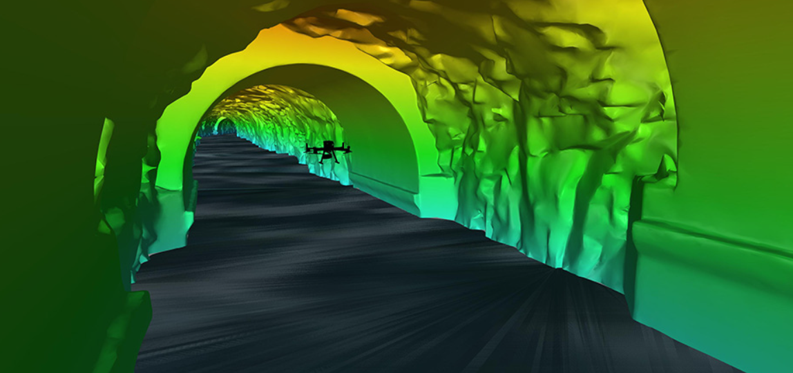
Autonomous drones are capturing critical data for tailrace surveys. In the Kitimat mountain range along the northwest coast of British Columbia, a 475-meter-long, 8-meter-wide tailrace tunnel channels water from a hydroelectric plant within the mountain. The client required a detailed survey of the tunnel’s interior for ongoing maintenance, but shutting down the tailrace for inspection was not an option. A specialized team initiated an autonomous drone mission to capture 3D scans inside the tunnel, providing high-resolution data essential for structural assessment.
The team needed to survey the tunnel’s interior without halting operations. Early discussions considered remote-operated vehicles (ROVs), autonomous surface vessels, and sensor-equipped floating devices. Ultimately, they opted for an aerial solution.
The team planned the mission meticulously to ensure a safe inspection and minimize risks, considering factors such as:
Curved tunnel structure
Half-kilometer journey into the mountain
Low to zero visibility
GPS-denied environment (no signal transmission between operator and equipment)
Outflow speed and turbulence
The project manager highlighted the choice of a drone equipped with high-resolution LiDAR, video, and motion units, coupled with an autonomous navigation system using SLAM technology. This setup allowed the drone to operate beyond visual line of sight (BVLOS) and communication range in GPS-denied environments.
Comprehensive risk planning included recovery nets, carefully planned flight paths to avoid obstacles, and disabling GNSS to prevent interference from power lines during approach. The team used precise control points and proprietary software to create point clouds, 3D models, and fly-through videos for a thorough structural assessment.
Inspections in GNSS-Denied Environments
Drone technology is increasingly popular in civil engineering for inspections in areas with limited satellite signals. Drones assist in inspecting tunnels, ventilation shafts, pipelines, and culverts. Regular inspections are essential but often costly and time-consuming with traditional methods. Additionally, visual inspections may miss potential defects. Drones equipped with optical and highly sensitive cameras offer ideal solutions for initial assessments, reducing costs, time, and risks to inspectors and technicians.
Autonomous Inspection Drones
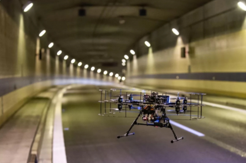
A development team created systems for precise localization and navigation in GNSS-denied environments. This innovative technology is designed to capture high-quality images in complex tunnel environments with exceptional accuracy and efficiency.
The system was tested under real conditions during the temporary closure of the longest road tunnel in the Czech Republic. It successfully demonstrated the ability to capture detailed images in challenging conditions such as low light and dust.
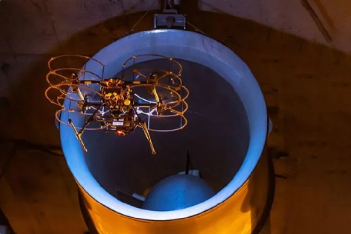
Equipped with advanced technology, these drones can also inspect narrow auxiliary tunnels used for venting emissions. The toxic environment poses risks to maintenance crews. Autonomous drones expedite inspections during tunnel operations, reducing human exposure to harmful fumes and revolutionizing maintenance practices.
Drones for Bridge Inspections
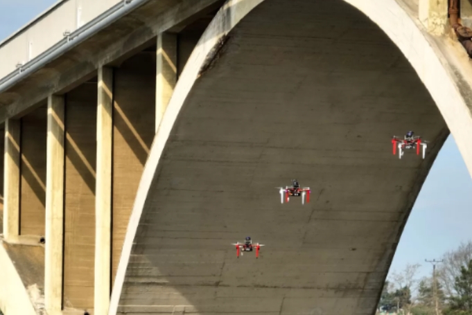
Autonomous drones are designed for smooth transitions between GNSS-enabled and GNSS-denied environments during bridge inspections.
Drone technology is increasingly valuable in civil engineering for inspecting infrastructure in areas with full, limited, or no GNSS signals. Drones play a critical role in inspecting bridges, viaducts, and other structures that pose risks for manual intervention.
Regular inspections are necessary, but traditional methods are inefficient, costly, and time-consuming. Integrated drone technology facilitates real-time data collection and analysis, enabling engineers to make informed decisions quickly. High-resolution imagery and videos support detailed evaluations that can be revisited to ensure no defects are overlooked. Drones enhance safety and efficiency, navigating complex environments where conventional equipment may struggle.
- Reinforcement Learning Enables Bipedal Robot to Conquer Challenging Terrain
- Drones for 3D Indoor Exploration-Cultural Relics Protection and Indoor Survey
- Industry Application: Intelligent Unmanned Operation Solutions for Lakes – Rapid Deployment for Continuous Protection
- High-Altitude Cleaning Case Introduction - Drone Spraying and Cleaning
- New Performance: SLAM Handheld Lidar Scanner + External Panoramic Camera New Combination

